 وظّف الآن
 راسل Srihari
هل تريد ملفاً شخصياً كهذا؟
انضمّ إلى آلاف المهنيين الإخباريين الذين يستخدمون journalist.net لعرض أعمالهم والحصول على عمل من كبرى المنافذ الإعلامية.
ابدأ الآن
شاهد كيف يعمل
تواصل عبر Journalist.net
1
محترفون موثَّقون
خضع كل صحفي على هذه المنصّة للتحقّق يدوياً من قِبل فريقنا في لندن. أنت تتواصل مع مهني إعلامي مؤكَّد.2
تعامل محمي
نحمي تفاصيل التواصل الخاصة بالصحفيين ونوفّر تغطية تأمينية لجميع الحجوزات. ويعمل الطرفان بثقة وأمان.3
دفع آمن
تُحتجَز المدفوعات في حساب ضمان وتُحرَّر عند تسليم العمل. يُضمن للصحفيين الحصول على أجرهم، ويوافق العملاء قبل اعتماد الأموال نهائياً.ألا تزال لديك أسئلة؟
راجِع الأسئلة الشائعةAbout Srihari
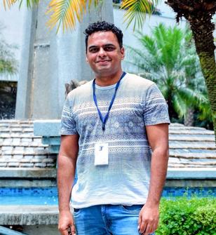
Srihari Karanth طيار طائرات الدرون معتمد من DGCA وصحفي بصري مقيم في بنغالور، معروف بالتقاط سرديات جوية قوية في جميع أنحاء الهند. يركز عمله الصحفي على التنمية الحضرية والبنية التحتية والسياحة والتراث الثقافي والمهرجانات وتحولات قطاع العقارات. لقد وثق توسيعات المترو والطرق السريعة ومتنزهات التكنولوجيا والمعابد التاريخية والتجمعات العامة واسعة النطاق من خلال تصوير سينمائي بالدرون عالي التأثير.

ما يميز عمله هو الجمع بين دقة الطيران التقنية ورؤية السرد القصصي. Srihari لا يكتفي بالتقاط المشاهد من السماء — بل يعرض الحجم والتناسق والسياق الذي غالبًا ما تغفل عنه التغطية على مستوى الأرض. لقد وصلت تغطيته الجوية لممرات التكنولوجيا في بنغالور والبنية التحتية الناشئة والمعالم التراثية إلى ملايين المشاهدين، مع إبرازات ومشاركات من جهات حكومية وهيئات سياحية. يجمع عمله بين الصحافة والوضوح السينمائي، مقدمًا للجمهور منظورًا جديدًا عن نمو الهند وعمقها الثقافي.
معرض الأعمال
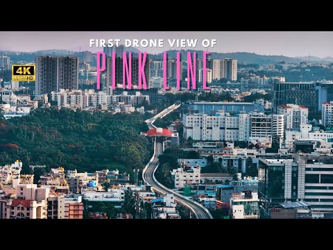
Bengaluru, Karnataka — In a first-of-its-kind aerial documentation, drone footage has captured the progress and trial runs of the Pink Line of Namma Metro, offering the public an uninterrupted view of this transformational urban transport corridor as it takes shape above the city’s busy streets.
The Pink Line, part of Bengaluru’s expanding metro network, will connect several major hubs — including JP Nagar, Jayadeva Hospital, IIM Bangalore, Hulimavu, and Tavarekere — spanning a critical stretch that eases long commutes across south and central Bengaluru.
Drone shots showcase the elevated tracks threading through dense traffic corridors, revealing the scale of infrastructure and how the alignment interacts with the urban fabric below. These aerial visuals, shot during trial runs with peak-hour road traffic visible beneath, give citizens a unique birds-eye perspective on both construction and the line in motion.
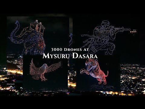
On 28 September 2025, a coordinated swarm of 2,983 drones took to the night sky to form a giant tiger, India’s national animal in a landmark achievement for aerial storytelling. The formation officially secured the record for the “Largest aerial image of a mammal formed by multirotor drones,” surpassing the previous benchmark of 1,985 drones!
Organized by the Chamundeshwari Electricity Supply Corporation (CESC) Mysore and executed by Indian drone technology pioneers BotLab Dynamics, the show was part of a four-night series of drone light performances during the 10-day festival. Thousands of spectators gathered in person, and millions more worldwide watched viral footage shared across social media platforms.
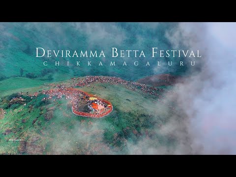
Deviramma Betta, located near Chikkamagalur, is home to the sacred Deviramma Temple, which opens only once a year during Deepavali.
Lakhs of devotees trek 7.5 km uphill (and 7.5 km back) barefoot to seek the goddess’s blessings.
The drone footage, filmed during the early morning hours of the festival, captures thousands of pilgrims ascending the hill under mist-covered skies. From above, the rush of devotees contrasted beautifully against the dark slopes, offering a rare perspective of faith, endurance, and celebration merging into one powerful visual.